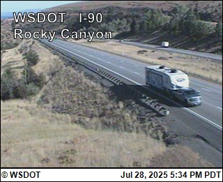
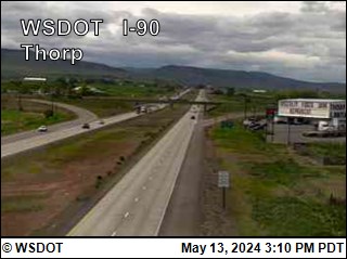
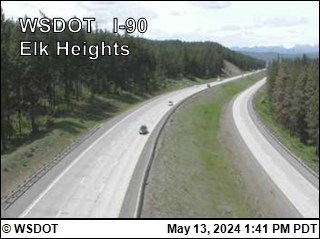
Blewett Pass US 97Reports have ended for this season. Traditionally weather and road conditions are reported on this page from November 1 to April 1. Should adverse weather occur that will impact travel, updates will be provided as information is available.
WSDOT · Updated Aug 16, 11:53 PM
Manastash Ridge I-82Traditionally weather and road conditions are reported on this page from November 1 to April 1. Should adverse weather occur that will impact travel, updates will be provided as information is available.
65°F · Updated Sep 7, 9:15 PM
Snoqualmie Pass I-90Traditionally weather and road conditions are reported on this page from November 1 to April 1. Should adverse weather occur that will impact travel, updates will be provided as information is available. / Travel impacts will be updated here if conditions cause delays of an hour or more. For other cross-state travel conditions, check WSDOT's real-time travel map.
Westbound milepost 53 to 52 Snoqualmie Pass. Tuesday, Sept. 8 to Thursday, Sept. 10 from 9 a.m. to 3:30 p.m. daily, there will be single lane closures for bridge work.
Westbound from milepost 54 to 47 Snoqualmie Pass. Monday, Sept. 7 at 6 a.m. until Thursday, Sept. 10 at 4:30 p.m. there will be continuous single-lane closures for maintenance work.
Vantage Bridge milepost 136 to 138 both directions: There are single-lane closures, reduced speeds and 9-ft width restrictions in place 24/7 until further notice. Eastbound width restriction begins at Exit 110, the junction of I-82 near Ellensburg. Westbound width restriction begins at Exit 149 the junction of SR 281 near George.
Westbound I-90 (milepost 67 to 64) near Easton. Tuesday, September 8 through Thursday, September 10 from 5 p.m. to 5 a.m. daily, there will a be single-lane closure with a 12-ft width restriction for routine roadwork.
Fire & safety alertHigh prioritySource: Watch Duty Evacuation Updates
Evacuation update for Three Queens Fire — Kittitas County
Three Queens Fire currently has evacuation information in Kittitas County. The highest reported area level is Level 3.
Current county-scoped evacuation fields from the active Watch Duty incident record.
- Level 3: A Level 3 (Go Now) Evacuation is in effect for the area depicted in red on the Kittitas County Evacuation Map
- Level 2: A Level 2 (Set) Evacuation is in effect for the area depicted in yellow on the Kittitas County Evacuation Map
- Level 1: A Level 1 (Ready) Evacuation is in effect for the area depicted in green on the Kittitas County Evacuation Map
Watch Duty updated: Sep 9, 2026 5:27 PM PDT.
These levels apply only to the areas described above in Kittitas County; levels listed for other counties are not carried over.
Confirm boundaries and instructions with local authorities.
Fire & safety alertHigh prioritySource: Watch Duty Evacuation Updates
Evacuation update for Goat Fire — Kittitas County
Goat Fire currently has evacuation information in Kittitas County. The highest reported area level is Level 3.
Current county-scoped evacuation fields from the active Watch Duty incident record.
- Level 3: A Level 3 (Go Now) Evacuation is in effect for the area depicted in red on the Kittitas County Evacuation Map.
Watch Duty updated: Sep 9, 2026 5:29 PM PDT.
These levels apply only to the areas described above in Kittitas County; levels listed for other counties are not carried over.
Confirm boundaries and instructions with local authorities.
WDFW reported a black bear wildlife incident in Kittitas County on Sep 1, 2026 11:45 AM PDT. Status: HUMAN FOOD SOURCE.
Reported: Sep 1, 2026 11:45 AM PDT
Species: Black Bear
Count: 1 ANIMAL
WDFW status: HUMAN FOOD SOURCE
Notes: Citizen reported their garbage/pet food/animal feed/bird seed was consumed by a black bear, WDFW investigated and confirmed it was a black bear. Advice provided.
Approximate public map location: 47.27468, -121.0784
Source: WDFW predatory wildlife incident map. Public reports are shown in the general vicinity of the incident.
WDFW reported a black bear wildlife incident in Kittitas County on Sep 1, 2026 7:09 AM PDT. Status: PROPERTY DAMAGE.
Reported: Sep 1, 2026 7:09 AM PDT
Species: Black Bear
Count: 1 ANIMAL
WDFW status: PROPERTY DAMAGE
Notes: Citizen reported sighting a black bear in the area, WDFW confirmed the sighting. Advice provided.
Approximate public map location: 47.2529, -121.04898
Source: WDFW predatory wildlife incident map. Public reports are shown in the general vicinity of the incident.
WDFW reported a cougar wildlife incident in Kittitas County on Sep 1, 2026 4:57 PM PDT. Status: UNCONFIRMED SIGHTING.
Reported: Sep 1, 2026 4:57 PM PDT
Species: Cougar
Count: 1 ANIMAL
WDFW status: UNCONFIRMED SIGHTING
Notes: Citizen reported sighting a cougar in the area, WDFW cannot confirm at this time.
Approximate public map location: 47.18337, -120.9609
Source: WDFW predatory wildlife incident map. Public reports are shown in the general vicinity of the incident.
PNW Roads accesses and transmits your device location while the app is open to automatically match your current county and show nearby road, weather, fire, health, and safety alerts. Coordinates are sent securely to PNW Roads and the U.S. Census Geocoder for this lookup, are not intentionally stored in the PNW Roads application database, and are not used for advertising.
You can continue without sharing location and choose a state or county manually.