BACK to All County Map North Central Washington

Okanogan County

County road alerts, weather impacts, closures, construction notices, and local safety resources for Okanogan County.

WSDOT live data

Travel Conditions

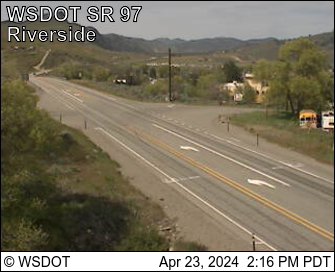
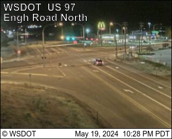
3 stations / 4 cameras / 3 passes

Road Weather Stations

3 nearby
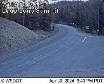
Loup Loup Pass on SR 20 at mp 214.50 12.7 mi away · Updated Sep 10, 5:30 AM
Air61 F Wind2 mph / gust 3 mph WNW RainNot reported Visibility1 mi

N/A · Humidity 56%

Ray Rock 26.0 mi away · Updated Sep 10, 5:29 AM
AirNot reported Wind2 mph / gust 2 mph N RainNot reported VisibilityNot reported

N/A · Humidity 15%

Wauconda Pass on SR 20 at mp 288.72 37.6 mi away · Updated Sep 10, 5:18 AM
Air52 F Wind1 mph / gust 2 mph E RainNot reported VisibilityNot reported

N/A · Humidity 74%

WSDOT Cameras

4 cameras

Pass Conditions

3 passes
Loup Loup Pass SR 20 Reports have ended for this season. Traditionally weather and road conditions are reported on this page from November 1 to April 1. Should adverse weather occur that will impact travel, updates will be provided as information is available.
62°F · Updated Apr 24, 6:54 AM
Disautel Pass SR 155 SR 155 is now open. The speed limit is reduced to 45 MPH through a 32-mile section from MP 46 to 78 for the safety of fire crews entering the highway from side roads. Fire and evacuation information available at: https://www.facebook.com/CCTBroadcasts/
WSDOT · Updated Aug 6, 12:12 PM
Wauconda Pass SR 20 Reports have ended for this season. Traditionally weather and road conditions are reported on this page from November 1 to April 1. Should adverse weather occur that will impact travel, updates will be provided as information is available.
52°F · Updated Apr 24, 6:54 AM
Road conditions

Road Alerts

2 active
Road alert Medium priority Source: WSDOT Highway Alerts

Maintenance

020: WSDOT alert for Okanogan County.

Travelers on SR 20 near Twisp will encounter slowdowns and delays at milepost 202 while developer associated with the Town of Twisp will work on the water lines. Expect alternating, one-lane, two-way traffic, flaggers and reduced speed limits. Work will occur from Sept. 8-10, from 7 p.m. to 6 a.m.
View source on WSDOT
Road alert Medium priority Source: WSDOT Highway Alerts

Maintenance

020: WSDOT alert for Okanogan County.

Travelers on SR 20 at milepost 202 near Twisp will encounter slowdowns and delays from Sept. 8 to Sept. 10, from 7 p.m. to 6 a.m. while crews work on water lines. Expect alternating one-lane, two-way traffic with flaggers and reduced speed limits.
View source on WSDOT
Official air quality

Air Quality Alerts

0 active

No active Air Quality Alerts

No official Air Quality Alerts are active for Okanogan County right now.

View the Washington Air Quality Map
Weather alerts

Weather Alerts / Red Flag Warnings

1 active
Weather alert Medium priority

Special Weather Statement issued August 16 at 1:11PM PDT by NWS Spokane WA

Special Weather Statement for Okanogan County.

At 110 PM PDT, Doppler radar was tracking a strong thunderstorm 7
miles northeast of Sherman Pass, or 56 miles east of Omak, moving
east at 10 mph.

HAZARD...Winds in excess of 30 mph and half inch hail.

SOURCE...Radar indicated.

IMPACT...Gusty winds could knock down tree limbs and blow around
unsecured objects. Minor hail damage to outdoor objects is
possible.

Locations impacted include...
Davis Lake.

This includes U.S. Highway 20 in Washington between mile markers 326
and 327.

If outdoors, consider seeking shelter inside a building.

Torrential rainfall is also occurring with this storm and may lead to
localized flooding. Do not drive your vehicle through flooded
roadways.
Fire & public safety

Fire & Safety Alerts

4 posted
Fire alert High priority Source: NIFC WFIGS Incident Locations

Sinlahekin Fire

Sinlahekin Fire listed by WFIGS in Okanogan County at 166,018 acres.

Reported size: 166,018 acres.
Containment: 76%.
Discovered: Jul 26, 2026 2:12 PM PDT.
Updated: Sep 9, 2026 4:11 PM PDT.
Description: 1 Miles W from Tonasket, WA.
Jurisdiction: DNR.
Protecting agency: DNR.
Dispatch center: WANEC.
Fire cause: Undetermined.
Fire behavior: Minimal.
Personnel: 895.
Watch Duty incident updated: Sep 9, 2026 4:22 PM PDT.
Watch Duty reported size: 166,018 acres.
Watch Duty containment: 76%.
Fire alert High priority Source: NIFC WFIGS Incident Locations

Ptarmigan Fire

Ptarmigan Fire listed by WFIGS in Okanogan County at 25,166 acres.

Reported size: 25,166 acres.
Containment: 73%.
Discovered: Jul 17, 2026 8:21 AM PDT.
Updated: Sep 9, 2026 11:44 AM PDT.
Description: 20 Miles NW from Mazama, WA.
Jurisdiction: USFS.
Protecting agency: USFS.
Dispatch center: WACWC.
Fire cause: Natural.
Fire behavior: Minimal.
Personnel: 5.
Watch Duty incident updated: Sep 9, 2026 11:38 AM PDT.
Watch Duty reported size: 25,166 acres.
Watch Duty containment: 73%.
Fire & safety alert Medium priority Source: Watch Duty Evacuation Updates

Evacuation update for Sinlahekin Fire — Okanogan County

Sinlahekin Fire currently has evacuation information in Okanogan County. The highest reported area level is Level 2.

Current county-scoped evacuation fields from the active Watch Duty incident record.
- Level 2: A Level 2 "Be Ready" status is in place, see the Okanogan Perimeter Map for the full parameters.
- Level 1: A Level 1 "Advisory" status is in place, see the Okanogan Perimeter Map for the full parameters.
Watch Duty updated: Sep 9, 2026 4:22 PM PDT.
These levels apply only to the areas described above in Okanogan County; levels listed for other counties are not carried over.
Confirm boundaries and instructions with local authorities.
View live safety information
Fire & safety alert Medium priority Source: Washington SEOC Evacuation Zones

Washington SEOC evacuation zones — Okanogan County

5 active evacuation zone(s) are mapped for Okanogan County. The highest mapped zone is Level 2.

Official active evacuation zones from the Washington State Emergency Operations Center statewide layer.
Checked by PNW Roads: Sep 10, 2026 5:42 AM PDT.
- Level 2 — A250: Auto-aggregated from https://services1.arcgis.com/ZGqB535QDPuVpg01/arcgis/rest/services/okanogan_public_access_zones_view/FeatureServer/0 on 2026-09-10T12:31:51.704594+00:00. Raw evac value: 'evacuation_warning_zone'.
- Level 2 — A330B: Auto-aggregated from https://services1.arcgis.com/ZGqB535QDPuVpg01/arcgis/rest/services/okanogan_public_access_zones_view/FeatureServer/0 on 2026-09-10T12:31:51.704594+00:00. Raw evac value: 'evacuation_warning_zone'.
- Level 2 — A1360B: Auto-aggregated from https://services1.arcgis.com/ZGqB535QDPuVpg01/arcgis/rest/services/okanogan_public_access_zones_view/FeatureServer/0 on 2026-09-10T12:31:51.704594+00:00. Raw evac value: 'evacuation_warning_zone'.
- Level 1 — A208A: Auto-aggregated from https://services1.arcgis.com/ZGqB535QDPuVpg01/arcgis/rest/services/okanogan_public_access_zones_view/FeatureServer/0 on 2026-09-10T12:31:51.704594+00:00. Raw evac value: 'evacuation_order_lifted_zone'.
- Level 1 — C200A: Auto-aggregated from https://services1.arcgis.com/ZGqB535QDPuVpg01/arcgis/rest/services/okanogan_public_access_zones_view/FeatureServer/0 on 2026-09-10T12:31:51.704594+00:00. Raw evac value: 'evacuation_order_lifted_zone'.
The highest level applies only to the mapped zones, not to the entire county.
View live safety information
Wildlife safety

Wildlife Safety Alerts

1 posted
Wildlife safety alert Medium priority Source: WDFW Predatory Wildlife Incidents

Black Bear reported in Okanogan County

WDFW reported a black bear wildlife incident in Okanogan County on Aug 31, 2026 10:18 AM PDT. Status: HUMAN FOOD SOURCE.

Reported: Aug 31, 2026 10:18 AM PDT
Species: Black Bear
Count: 3 ANIMALS
WDFW status: HUMAN FOOD SOURCE
Notes: Citizen reported their garbage/pet food/animal feed/bird seed was consumed by a black bear, WDFW investigated and confirmed it was a black bear. Advice provided.
Approximate public map location: 48.37819, -119.7248
Source: WDFW predatory wildlife incident map. Public reports are shown in the general vicinity of the incident.
View source on WDFW Predatory Wildlife Incidents
Local links

Resources

64 links