BACK to All County Map North Puget Sound

Snohomish County

County road alerts, weather impacts, closures, construction notices, and local safety resources for Snohomish County.

WSDOT live data

Travel Conditions

4 stations / 4 cameras / 3 passes

Road Weather Stations

4 nearby
Index-Galena Road on US 2 at mp 35.62 17.2 mi away · Updated Sep 10, 5:30 AM
Air58 F Wind0 mph / gust 2 mph SW RainNot reported Visibility1 mi

N/A · Humidity 93%

Main St on SR 522 at mp 23.03 20.0 mi away · Updated Sep 10, 5:29 AM
Air59 F Wind0 mph / gust 0 mph E RainNot reported Visibility1 mi

N/A · Humidity 86%

I-5 / SR2 Interchange (Everett) at mp 193.91 23.2 mi away · Updated Sep 10, 5:30 AM
Air64 F Wind0 mph / gust 0 mph N RainNot reported VisibilityNot reported

N/A · Humidity 78%

I-5 / SR526 Interchange at mp 189.19 25.3 mi away · Updated Sep 10, 5:29 AM
Air61 F WindNot reported N/A RainNot reported VisibilityNot reported

N/A

WSDOT Cameras

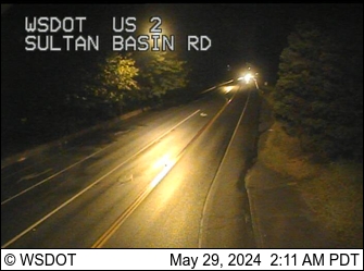
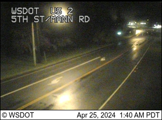
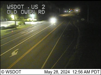
4 cameras

Pass Conditions

3 passes
Stevens Pass US 2 Reports have ended for this season. Traditionally weather and road conditions are reported on this page from November 1 to April 1. Should adverse weather occur that will impact travel, updates will be provided as information is available.
WSDOT · Updated Aug 16, 11:48 PM
Tiger Mountain SR18 Reports have ended for this season. Traditionally weather and road conditions are reported from November 1 to April 1. Should adverse weather occur that will impact travel, updates will be provided as information is available
WSDOT · Updated Aug 16, 11:52 PM
Snoqualmie Pass I-90 Traditionally weather and road conditions are reported on this page from November 1 to April 1. Should adverse weather occur that will impact travel, updates will be provided as information is available. / Travel impacts will be updated here if conditions cause delays of an hour or more. For other cross-state travel conditions, check WSDOT's real-time travel map.
53°F · Updated Sep 7, 9:16 PM
Road conditions

Road Alerts

8 active
Road closure High priority Source: WSDOT Highway Alerts

Rest Area

005: WSDOT alert for Snohomish County.

Beginning Sept. 24, 2021 until further notice: The southbound Interstate 5 Silver Lake Rest Area is closed for maintenance indefinitely. There is no access for recreational vehicle dumping at this location.
View source on WSDOT
Construction High priority Source: WSDOT Highway Alerts

Construction

527: WSDOT alert for Snohomish County.

One lane of southbound SR 527 at 220th Street Southeast (milepost 3.0) will be closed nightly from 9 p.m. Tuesday, Sept. 8 to 4 a.m. Friday, Sept. 11.
View source on WSDOT
Construction High priority Source: WSDOT Highway Alerts

Construction

405: WSDOT alert for Snohomish County.

The right general-purpose lane of southbound I-405 from SR 527 (milepost 27.65) to Northeast 195th Street (milepost 24.75) will be closed overnight from 10:30 p.m. Thursday, Sept. 10 to 4 a.m. Friday, Sept. 11.
View source on WSDOT
Construction High priority Source: WSDOT Highway Alerts

Construction

527: WSDOT alert for Snohomish County.

The northbound SR 527 off-ramp to northbound I-405 will be closed overnight from 11 p.m. Tuesday, Sept. 8 to 4 a.m. Wednesday, Sept. 9 and overnight from 11 p.m. Thursday, Sept. 10 to 5 a.m. Friday, Sept. 1
View source on WSDOT
Construction Low priority Source: WSDOT Highway Alerts

Construction

524: WSDOT alert for Snohomish County.

Westbound SR 524/196th Street SW has been reduced to one lane and eastbound SR 524/196th Street SW has been reduced to two lanes, 24 hours a day, near the I-5 interchange for a city of Lynnwood construction project.
View source on WSDOT
Road alert Low priority Source: WSDOT Highway Alerts

Maintenance

005: WSDOT alert for Snohomish County.

From 10 to 11:30 a.m. Thursday, Sept. 10, both directions of the HOV Interstate 5 on- and off- ramps at 41st Street/Broadway (milepost 192) will close. Traffic can still use the mainline I-5 exit at Broadway.
View source on WSDOT
Road alert Low priority Source: WSDOT Highway Alerts

Maintenance

099: WSDOT alert for Snohomish County.

From 9 p.m. Thursday, Sept. 10 to 5 a.m. Friday, Sept. 11 southbound State Route 99 traffic will alternate with flaggers at Russell Way/North Manor Way (milepost 51) for utilities work.
View source on WSDOT
Road alert Low priority Source: WSDOT Highway Alerts

Maintenance

529: WSDOT alert for Snohomish County.

Daily from 9 a.m. to 2:30 p.m. beginning Wednesday, Sept. 9 to 2:30 p.m. Friday, Sept. 11, the left lane of the southbound State Route 529 Snohomish River Bridge (milepost 3) will close for maintenance.
View source on WSDOT
Official air quality

Air Quality Alerts

0 active

No active Air Quality Alerts

No official Air Quality Alerts are active for Snohomish County right now.

View the Washington Air Quality Map
Weather alerts

Weather Alerts / Red Flag Warnings

0 active

No active weather alerts

No active weather alerts or Red Flag warnings have been posted for this county.

Public health

Health Dept Alerts

1 active
Health Dept alert Medium priority Source: WA DOH Shellfish Safety Map

Shellfish harvest closure - Snohomish County

WA DOH lists 3 current recreational shellfish closures in Snohomish County. Check the Shellfish Safety Map before harvesting.

WA DOH Shellfish Safety Map currently lists the following closed recreational harvest area(s):
- HOWARTH PARK - DARLINGTON BEACH: Butter Clams,Varnish Clams (This beach is located in a densely populated urban area. Large sewage treatment outfalls and urban stormwater runoff are sources of contamination concern.)
- KAYAK POINT CP: Butter Clams,Varnish Clams (Water quality and shoreline conditions meet public health standards for recreational shellfish harvesting.)
- MUKILTEO: Butter Clams,Varnish Clams (This beach is located in a densely populated urban area. Large sewage treatment outfalls and urban stormwater runoff are sources of contamination concern.)
Cooking or freezing does not remove marine biotoxins. WA DOH shellfish safety hotline: 1-800-562-5632.
View source on WA DOH Shellfish Safety Map
Fire & public safety

Fire & Safety Alerts

2 posted
Fire alert High priority Source: NIFC WFIGS Incident Locations

Miners Fire

Miners Fire listed by WFIGS in Snohomish County at 144 acres.

Reported size: 144 acres.
Containment: 0%.
Discovered: Aug 14, 2026 2:06 PM PDT.
Updated: Sep 9, 2026 6:33 PM PDT.
Description: 35 Miles W from Darrington, WA.
Jurisdiction: USFS.
Protecting agency: USFS.
Dispatch center: WAPSC.
Fire cause: Natural.
Fire behavior: Moderate.
Watch Duty incident updated: Sep 9, 2026 6:43 PM PDT.
Watch Duty reported size: 144 acres.
Watch Duty containment: 0%.
Fire alert Medium priority Source: NIFC WFIGS Incident Locations

Gamma Creek Fire

Gamma Creek Fire listed by WFIGS in Snohomish County at 29 acres.

Reported size: 29 acres.
Discovered: Aug 23, 2026 6:24 PM PDT.
Updated: Sep 9, 2026 6:33 PM PDT.
Jurisdiction: USFS.
Protecting agency: USFS.
Dispatch center: WAPSC.
Fire cause: Undetermined.
Watch Duty incident updated: Sep 9, 2026 6:38 PM PDT.
Watch Duty reported size: 29 acres.
Wildlife safety

Wildlife Safety Alerts

5 posted
Wildlife safety alert Medium priority Source: WDFW Predatory Wildlife Incidents

Black Bear reported in Snohomish County

WDFW reported a black bear wildlife incident in Snohomish County on Sep 1, 2026 4:16 PM PDT. Status: UNCONFIRMED SIGHTING.

Reported: Sep 1, 2026 4:16 PM PDT
Species: Black Bear
Count: 1 ANIMAL
WDFW status: UNCONFIRMED SIGHTING
Notes: Citizen reported sighting a black bear in the area, WDFW confirmed it was a different species.
Approximate public map location: 47.81242, -122.1375
Source: WDFW predatory wildlife incident map. Public reports are shown in the general vicinity of the incident.
View source on WDFW Predatory Wildlife Incidents
Wildlife safety alert Low priority Source: WDFW Predatory Wildlife Incidents

Black Bear reported in Snohomish County

WDFW reported a black bear wildlife incident in Snohomish County on Aug 31, 2026 1:02 PM PDT. Status: UNCONFIRMED SIGHTING.

Reported: Aug 31, 2026 1:02 PM PDT
Species: Black Bear
Count: 1 ANIMAL
WDFW status: UNCONFIRMED SIGHTING
Notes: Citizen reported sighting a black bear in the area, WDFW cannot confirm at this time.
Approximate public map location: 47.84336, -122.22463
Source: WDFW predatory wildlife incident map. Public reports are shown in the general vicinity of the incident.
View source on WDFW Predatory Wildlife Incidents
Wildlife safety alert Low priority Source: WDFW Predatory Wildlife Incidents

Black Bear reported in Snohomish County

WDFW reported a black bear wildlife incident in Snohomish County on Aug 31, 2026 11:22 AM PDT. Status: UNCONFIRMED SIGHTING.

Reported: Aug 31, 2026 11:22 AM PDT
Species: Black Bear
Count: 1 ANIMAL
WDFW status: UNCONFIRMED SIGHTING
Notes: Citizen reported sighting a black bear in the area, WDFW cannot confirm at this time.
Approximate public map location: 47.84498, -122.21709
Source: WDFW predatory wildlife incident map. Public reports are shown in the general vicinity of the incident.
View source on WDFW Predatory Wildlife Incidents
Wildlife safety alert Low priority Source: WDFW Predatory Wildlife Incidents

Black Bear reported in Snohomish County

WDFW reported a black bear wildlife incident in Snohomish County on Aug 31, 2026 9:00 AM PDT. Status: UNCONFIRMED SIGHTING.

Reported: Aug 31, 2026 9:00 AM PDT
Species: Black Bear
Count: 1 ANIMAL
WDFW status: UNCONFIRMED SIGHTING
Notes: Citizen reported sighting a black bear in the area, WDFW cannot confirm at this time.
Approximate public map location: 48.0342, -122.08306
Source: WDFW predatory wildlife incident map. Public reports are shown in the general vicinity of the incident.
View source on WDFW Predatory Wildlife Incidents
Wildlife safety alert Low priority Source: WDFW Predatory Wildlife Incidents

Cougar reported in Snohomish County

WDFW reported a cougar wildlife incident in Snohomish County on Sep 1, 2026 8:41 AM PDT. Status: UNCONFIRMED SIGHTING.

Reported: Sep 1, 2026 8:41 AM PDT
Species: Cougar
Count: 1 ANIMAL
WDFW status: UNCONFIRMED SIGHTING
Notes: Citizen reported sighting a cougar in the area, WDFW cannot confirm at this time.
Approximate public map location: 48.11811, -121.93421
Source: WDFW predatory wildlife incident map. Public reports are shown in the general vicinity of the incident.
View source on WDFW Predatory Wildlife Incidents
Local links

Resources

64 links