BACK to All County Map Eastern Oregon

Grant County

County road alerts, weather impacts, closures, construction notices, and local safety resources for Grant County.

ODOT TripCheck live data

Travel Conditions

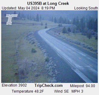
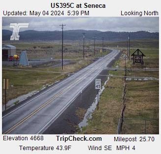
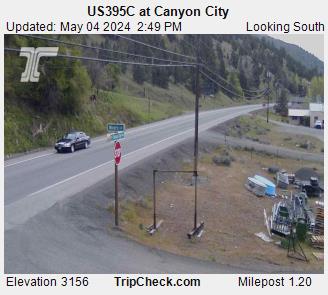
0 events / 4 cameras

Road events are assigned using explicit county data or the TripCheck marker coordinate inside official Oregon GIS county boundaries—never a broad distance radius. Feed cache updated Jul 27, 2026, 1:01 AM.

Nearby Road Events

0 nearby

No current TripCheck road events are matched near this county center.

TripCheck Cameras

4 cameras

Road & Weather Reports

0 current

TripCheck currently reports no active road-and-weather station reports near this county.

Road conditions

Road Alerts

0 active

No active road alerts

No active road alerts have been posted for Grant County yet.

Weather alerts

Weather Alerts / Red Flag Warnings

1 active
Weather alert Low priority Source: National Weather Service

Air Quality Alert issued July 24 at 11:08AM PDT by NWS Pendleton OR

Air Quality Alert for Grant County.

Oregon Department of Environmental Quality has issued an Air Quality
Advisory until noon PDT Monday.

For the Smoke Air Quality Advisory, wildfires burning in the region
combined with forecasted conditions will cause air quality to reach
unhealthy levels.

Pollutants in smoke can cause burning eyes, runny nose, aggravate
heart and lung diseases, and aggravate other serious health
problems. Limit outdoor activities and keep children indoors if it
is smoky. Please follow medical advice if you have a heart or lung
condition.

For additional information...please visit the Web site at
http://www.oregon.gov/DEQ
View source on National Weather Service
Public health

Health Dept Alerts

4 active
Health Dept alert High priority Source: Oregon Health Authority Public Health Advisories

Statewide Oregon Alert: Oregon reports measles outbreak; new wastewater dashboard tracks measles virus by county

This is a State Wide Alert for Oregon. Oregon Health Authority posted an official public health notice on Feb 19, 2026: Oregon reports measles outbreak; new wastewater dashboard tracks measles virus by county

This notice is displayed on every Oregon county page because it applies statewide. It does not mean the source identified a county-specific case, exposure, closure, or local outbreak in this county.

Follow the OHA source link for current statewide public health guidance.
View source on Oregon Health Authority Public Health Advisories
Health Dept alert High priority Source: Oregon Health Authority Public Health Advisories

Statewide Oregon Alert: Cyclosporiasis cases linked to national outbreak reported in Oregon

This is a State Wide Alert for Oregon. Oregon Health Authority posted an official public health notice on Jul 24, 2026: Cyclosporiasis cases linked to national outbreak reported in Oregon

This notice is displayed on every Oregon county page because it applies statewide. It does not mean the source identified a county-specific case, exposure, closure, or local outbreak in this county.

Follow the OHA source link for current statewide public health guidance.
View source on Oregon Health Authority Public Health Advisories
Health Dept alert High priority Source: Oregon Health Authority Public Health Advisories

Statewide Oregon Alert: OHA urges people to limit smoke exposure as wildfire season intensifies

This is a State Wide Alert for Oregon. Oregon Health Authority posted an official public health notice on Jul 24, 2026: OHA urges people to limit smoke exposure as wildfire season intensifies

This notice is displayed on every Oregon county page because it applies statewide. It does not mean the source identified a county-specific case, exposure, closure, or local outbreak in this county.

Follow the OHA source link for current statewide public health guidance.
View source on Oregon Health Authority Public Health Advisories
Health Dept alert Medium priority Source: FDA Food Recalls and Safety Alerts

Statewide Oregon Alert: PT Organics Limited Recalls Select Pumpkin Tree Peter Rabbit Organics Banana & Strawberry Fruit Puree Pouches Due to the Potential for Soft Plastic to Enter

This is a State Wide Alert for Oregon. FDA posted a food recall or safety advisory explicitly relevant to Oregon: PT Organics Limited Recalls Select Pumpkin Tree Peter Rabbit Organics Banana & Strawberry Fruit Puree Pouches Due to the Potential for Soft Plastic to Enter the Finished Product

This notice is displayed on every Oregon county page because it applies statewide. It does not mean the source identified a county-specific case, exposure, closure, or local outbreak in this county.

July 21st, 2026, PT Organics Limited of Lake Oswego, Oregon is voluntarily recalling select Pumpkin Tree Peter Rabbit Organics Banana & Strawberry 4 oz. (113 g) pouches because of an internal packaging defect that may result in the presence of a strand of soft, food-grade plastic in the finished pro
View source on FDA Food Recalls and Safety Alerts
Fire & public safety

Fire & Safety Alerts

7 posted
Fire & safety alert High priority Source: Oregon OEM Evacuation Areas

Salmon/Olive Butte Fires evacuation areas — Grant County

Oregon OEM maps 24 evacuation zone(s) for Salmon/Olive Butte Fires. The highest mapped zone is Level 3; this does not apply to the entire county.

The official Oregon OEM layer currently contains 24 mapped evacuation zone(s) for Salmon/Olive Butte Fires:
- Level 3: Salmon/Olive Butte Fires — Olive_1 (Fire)
- Level 3: Salmon/Olive Butte Fires — Olive_11 (Fire)
- Level 3: Salmon/Olive Butte Fires — Olive_12 (Fire; estimated population 5)
- Level 3: Salmon/Olive Butte Fires — Olive_13 (Fire; 2 structure(s))
- Level 3: Salmon/Olive Butte Fires — Olive_17 (Fire)
- Level 3: Salmon/Olive Butte Fires — Olive_2 (Fire; 1 structure(s))
- Level 3: Salmon/Olive Butte Fires — Olive_3 (Fire; estimated population 7)
- Level 3: Salmon/Olive Butte Fires — Olive_4 (Fire)
- Level 3: Salmon/Olive Butte Fires — Olive_5 (Fire; estimated population 2)
- Level 3: Salmon/Olive Butte Fires — Olive_6 (Fire; 1 structure(s))
- Level 3: Salmon/Olive Butte Fires — Olive_7 (Fire; estimated population 10)
- Level 3: Salmon/Olive Butte Fires — Olive_9 (Fire; estimated population 17)
- Level 3: Salmon/Olive Butte Fires — Salmon 12 (Fire; estimated population 20)
- Level 3: Salmon/Olive Butte Fires — Salmon_10 (Fire)
- Level 3: Salmon/Olive Butte Fires — Salmon_4 (Fire; 2 structure(s))
- Level 3: Salmon/Olive Butte Fires — Salmon_8 (Fire; estimated population 2)
- Level 3: Salmon/Olive Butte Fires — Salmon_9 (Fire; 1 structure(s))
- Level 2: Salmon/Olive Butte Fires — Olive 19 (Fire; estimated population 2)
- Level 2: Salmon/Olive Butte Fires — Olive 20 (Fire)
- Level 2: Salmon/Olive Butte Fires — Olive_10 (Fire; 1 structure(s))
- Level 2: Salmon/Olive Butte Fires — Salmon 11 (Fire)
- Level 2: Salmon/Olive Butte Fires — Salmon 13 (Fire; 2 structure(s))
- Level 2: Salmon/Olive Butte Fires — Salmon 14 (Fire; estimated population 17)
- Level 2: Salmon/Olive Butte Fires — Salmon_5 (Fire)
Most recently edited in the Oregon OEM layer: Jul 13, 2026 3:01 PM PDT.
The highest level applies only to the listed mapped zones, not to the entire county. Evacuation boundaries can change quickly; follow local sheriff or emergency management instructions.
View live fire information
Fire & safety alert High priority Source: Oregon OEM Evacuation Areas

Olive Butte evacuation areas — Grant County

Oregon OEM maps 3 evacuation zone(s) for Olive Butte. The highest mapped zone is Level 3; this does not apply to the entire county.

The official Oregon OEM layer currently contains 3 mapped evacuation zone(s) for Olive Butte:
- Level 3: Olive Butte — Olive 16 (Fire; estimated population 2)
- Level 2: Olive Butte — Olive 18 (Fire)
- Level 2: Olive Butte — Olive_15 (Fire; estimated population 230)
Most recently edited in the Oregon OEM layer: Jul 21, 2026 2:48 PM PDT.
The highest level applies only to the listed mapped zones, not to the entire county. Evacuation boundaries can change quickly; follow local sheriff or emergency management instructions.
View live fire information
Fire & safety alert High priority Source: Oregon OEM Evacuation Areas

Shingle evacuation areas — Grant County

Oregon OEM maps 7 evacuation zone(s) for Shingle. The highest mapped zone is Level 3; this does not apply to the entire county.

The official Oregon OEM layer currently contains 7 mapped evacuation zone(s) for Shingle:
- Level 3: Shingle — US-OR-GRA-GRN-115 (Fire; estimated population 60)
- Level 3: Shingle — US-OR-GRA-GRN-151 (Fire; 5 structure(s))
- Level 2: Shingle — US-OR-GRA-DAY-117 (Fire; estimated population 250)
- Level 2: Shingle — US-OR-GRA-GRN-091 (Fire; estimated population 20)
- Level 2: Shingle — US-OR-GRA-GRN-153 (Fire; estimated population 30)
- Level 1: Shingle — US-OR-GRA-GRN-095 (Fire)
- Level 1: Shingle — US-OR-GRA-GRN-119 (Fire; estimated population 12)
Most recently edited in the Oregon OEM layer: Jul 27, 2026 1:05 AM PDT.
The highest level applies only to the listed mapped zones, not to the entire county. Evacuation boundaries can change quickly; follow local sheriff or emergency management instructions.
View live fire information
Fire alert High priority Source: NIFC WFIGS Incident Locations

Olive Butte Fire

Olive Butte Fire listed by WFIGS in Grant County at 3,054 acres.

Reported size: 3,054 acres.
Containment: 60%.
Discovered: Jul 8, 2026 8:39 AM PDT.
Updated: Jul 26, 2026 5:24 PM PDT.
Description: 34 Miles SW from Baker City, OR.
Jurisdiction: USFS.
Protecting agency: USFS.
Dispatch center: ORBMC.
Fire cause: Natural.
View live fire information
Fire alert High priority Source: NIFC WFIGS Incident Locations

Salmon Fire

Salmon Fire listed by WFIGS in Grant County at 1,426 acres.

Reported size: 1,426 acres.
Containment: 60%.
Discovered: Jul 8, 2026 12:16 AM PDT.
Updated: Jul 26, 2026 5:22 PM PDT.
Description: 34 Miles SW from Baker City, OR.
Jurisdiction: USFS.
Protecting agency: USFS.
Dispatch center: ORBMC.
Fire cause: Undetermined.
View live fire information
Fire alert High priority Source: NIFC WFIGS Incident Locations

Bologna Fire

Bologna Fire listed by WFIGS in Grant County at 2,425 acres.

Reported size: 2,425 acres.
Containment: 44%.
Discovered: Jul 16, 2026 12:10 PM PDT.
Updated: Jul 26, 2026 5:29 PM PDT.
Description: 7 Miles NE from Kimberly, OR.
Jurisdiction: USFS.
Protecting agency: USFS.
Dispatch center: ORBMC.
Fire cause: Natural.
View live fire information
Fire & safety alert Low priority Source: Oregon OEM Evacuation Areas

Grant County evacuation zones (GRN)

Oregon OEM maps 2 evacuation zone(s) for Grant County zone group GRN. The highest mapped zone is Level 1; this does not apply to the entire county.

The official Oregon OEM layer currently contains 2 mapped evacuation zone(s) for Grant County zone group GRN:
- Level 1: US-OR-GRA-GRN-021 (Fire; estimated population 10)
- Level 1: US-OR-GRA-GRN-023 (Fire; estimated population 118)
Most recently edited in the Oregon OEM layer: Jul 27, 2026 1:05 AM PDT.
The highest level applies only to the listed mapped zones, not to the entire county. Evacuation boundaries can change quickly; follow local sheriff or emergency management instructions.
View live fire information
Wildlife safety

Wildlife Safety Alerts

0 posted

No wildlife safety alerts

No official cougar, bear, wolf, or other dangerous wildlife alerts have been posted for Grant County.

For an immediate threat, call 911. For non-emergency wildlife conflicts, contact the nearest Oregon Department of Fish and Wildlife office at 503-947-6000 or 800-720-6339.

ODFW wildlife safety news and alerts Find the nearest ODFW wildlife office ODFW living with cougars guidance ODFW bear conflict and safety guidance Oregon wildlife reporting resources
Local links

Resources

47 links